museum-digital
CTRL + Y
en
Kulturhistorisches Museum Schloss Merseburg Sonstige Bildwerke [2013/1497]
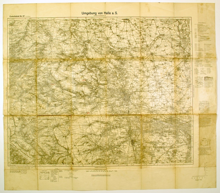
Umgebung von Halle a. S. (Kulturhistorisches Museum Schloss Merseburg CC BY-NC-SA)
Provenance/Rights: Kulturhistorisches Museum Schloss Merseburg (CC BY-NC-SA)
1 / 1 Previous<- Next->

Umgebung von Halle a. S.

Contact Cite this page Data sheet (PDF) Canonical version (record) Calculate distance to your current location Mark for comparison Graph view

Description

Die Karte der "Umgebung von Halle a. S." im Maßstab 1:100 000 (1 cm-Karte) ist der "Zusammendruck 1936 aus der Karte des Deutschen Reiches, Herausgegeben vom Reichsamt für Landesaufnahme, Berlin" (= Einheitsblatt Nr. 87). Das Kartenbild umfasst die Region zwischen Ermsleben und Köthen im Norden und Wiehe und Knauthain im Süden.
Am rechten Rand befindet sich eine umfangreiche Legende, am unteren Rand der Maßstab der Karte sowie eine Auflistung der betroffenen Landkreise, geordnet nach den Ländern Preußen, Thüringen, Sachsen. Das Kartenbild wird umrandet von einer Leiste mit der Gradeinteilung der geographischen Koordinaten.

Material/Technique

Papier; Druck

Measurements

71,8 x 81,5 cm Blattmaß

Kulturhistorisches Museum Schloss Merseburg

Object from: Kulturhistorisches Museum Schloss Merseburg

Die Bestände des Kulturhistorischen Museums Schloss Merseburg gehen zurück auf die Sammlung des 1906 gegründeten Vereins für Heimatkunde. Gesammelt...

Contact the institution

[Last update: ]

Usage and citation

The textual information presented here is free for non-commercial usage if the source is named. (Creative Commons Lizenz 3.0, by-nc-sa) Please name as source not only the internet representation but also the name of the museum.
Rights for the images are shown below the large images (which are accessible by clicking on the smaller images). If nothing different is mentioned there the same regulation as for textual information applies.
Any commercial usage of text or image demands communication with the museum.