museum-digital
CTRL + Y
en
Förder- und Heimatverein Stadt und Kloster Jerichow e.V. [V 2582-H]
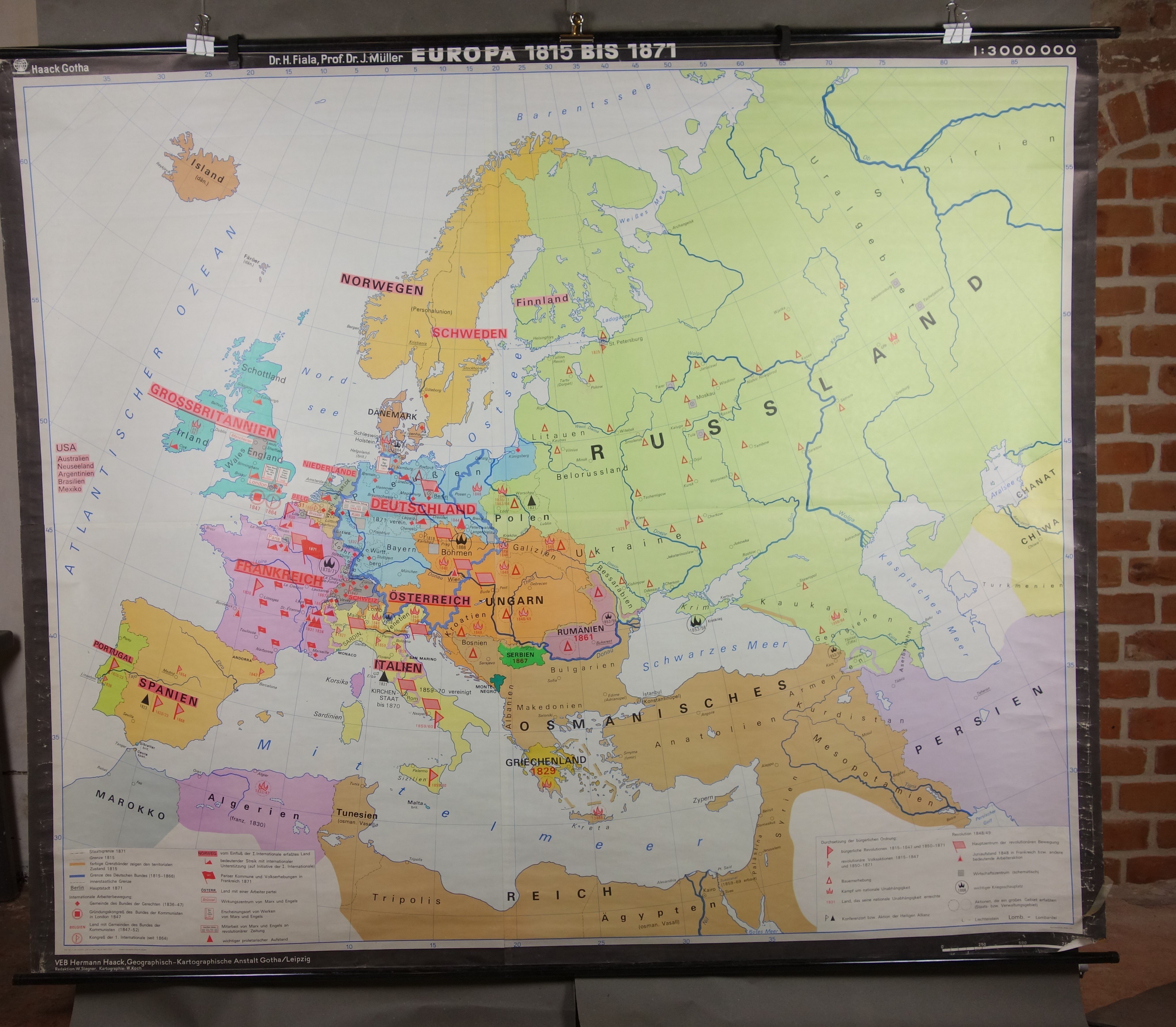
Wandkarte "Europa von 1815-1871" (Förder- und Heimatverein Stadt und Kloster Jerichow e.V. CC BY-NC-SA)
Provenance/Rights: Förder- und Heimatverein Stadt und Kloster Jerichow e.V. / Dieter Schultz (CC BY-NC-SA)
1 / 1 Previous<- Next->

Wandkarte "Europa von 1815-1871"

Contact Cite this page Data sheet (PDF) Canonical version (record) Calculate distance to your current location Mark for comparison Graph view

Description

Die Wandkarte "Europa von 1815-1871" ist aus Papier und oben und unten mit einem Metallholm versehen. Sie wurde an einem Kartenständer aufgehängt und im Unterricht um 1970 verwendet. Sie zeigt im Maßstab 1:3.000.000 die Karte Europas. Am rechten unteren Rand ist der Maßstab eingedruckt.

Als Impressum wird genannt:
VEB Hermann Haack, Geographisch-Kartographische Anstalt Gotha/ Leipzig
Redaktion: W. Stegner, Kartographie: W. Koch

Material/Technique

Papier, Metall

Measurements

L: 182 cm B: 220 cm

Part of

[Relation to time] [Relation to time]
1970
[Relation to time] [Relation to time]
1949
1948 1992
Förder- und Heimatverein Stadt und Kloster Jerichow e.V.

Object from: Förder- und Heimatverein Stadt und Kloster Jerichow e.V.

Der Verein besitzt ca. 1.800 Objekte aus Geschichte und Umfeld der Stadt Jerichow. Die Sammlung wurde ab 1990 schrittweise durch die Mitglieder des...

Contact the institution

[Last update: ]

Usage and citation

The textual information presented here is free for non-commercial usage if the source is named. (Creative Commons Lizenz 3.0, by-nc-sa) Please name as source not only the internet representation but also the name of the museum.
Rights for the images are shown below the large images (which are accessible by clicking on the smaller images). If nothing different is mentioned there the same regulation as for textual information applies.
Any commercial usage of text or image demands communication with the museum.