museum-digital
CTRL + Y
en
Stadtmuseum Bad Dürkheim im Kulturzentrum Haus Catoir Karten und Pläne [2018/0047]
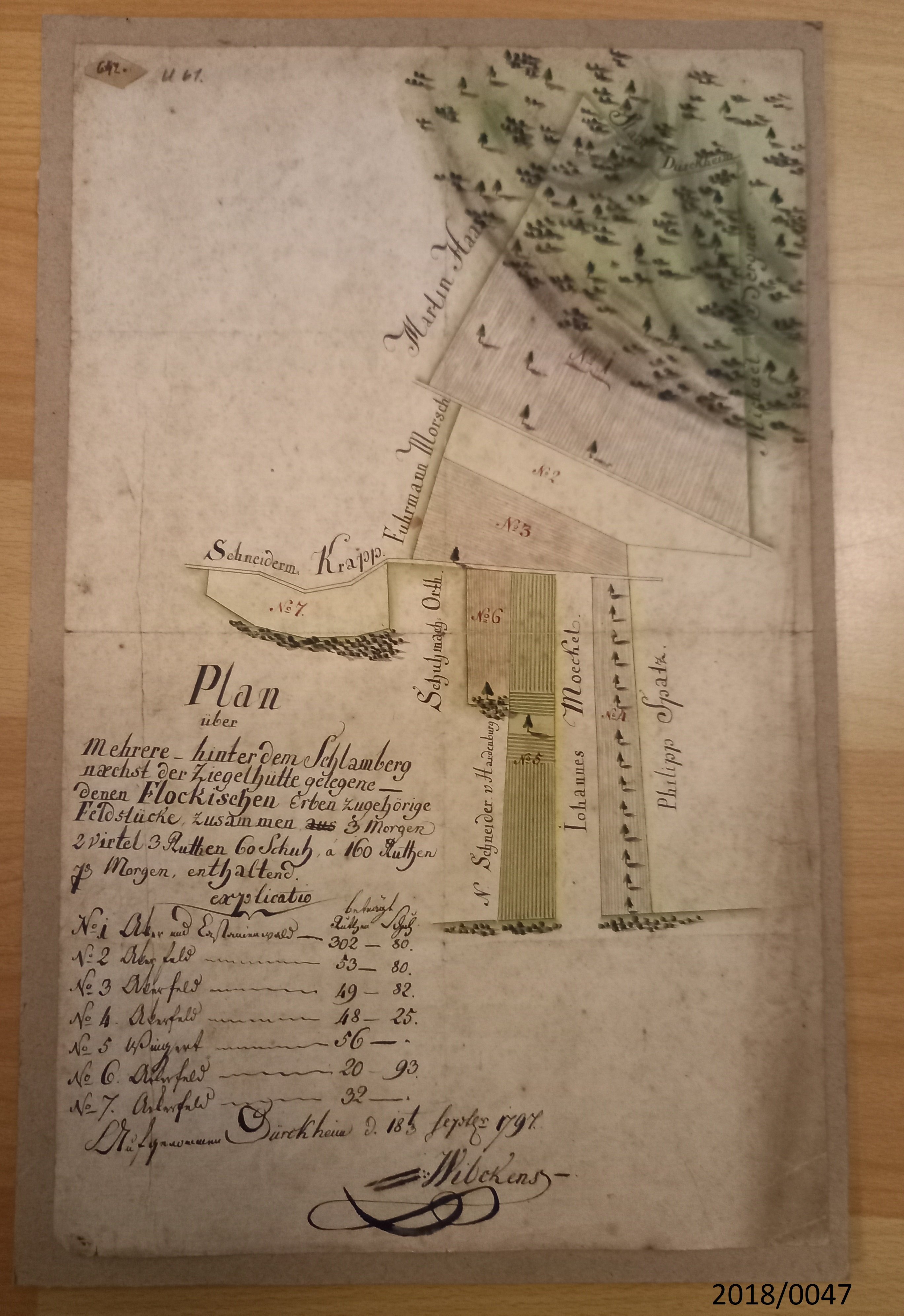
Plan über Grundstücke hinter dem Schlamberg (Stadtmuseum Bad Dürkheim im Kulturzentrum Haus Catoir CC BY-NC-SA)
Provenance/Rights: Stadtmuseum Bad Dürkheim im Kulturzentrum Haus Catoir / Britta Hallmann-Preuß (CC BY-NC-SA)
1 / 1 Previous<- Next->

Plan über Grundstücke hinter dem Schlamberg

Contact Cite this page Data sheet (PDF) Canonical version (record) Calculate distance to your current location Mark for comparison Graph view

Description

"Plan über mehrere hinter dem Schlammberg nächst der Ziegelhütte gelegenen denen Flockischen Erbe zugehörigen Feldstücke zusammen 3 Morgen 2 Virtel 3 Ruthen 60 Schuh a 160 Ruthen 7 Morgen enthaltend"
aus dem Jahr 1797
Als Eigentümer sind eingetragen
Martin Haas
Fuhrmann Morsch
Schneidermann Krapp
Schuhmacher Orth
Schneider von Hardenburg
Iohannes Moeckel
Philipp Spatz
Michael Bergner


Der Plan aus Papier ist auf starke Pappe aufgeklebt

Material/Technique

Papier / geschöpft, bemalt

Measurements

Länge: 35 cm, Breite: 22,5 cm

Stadtmuseum Bad Dürkheim im Kulturzentrum Haus Catoir

Object from: Stadtmuseum Bad Dürkheim im Kulturzentrum Haus Catoir

Der über 2000-jährigen Tradition des Weinbaus in Bad Dürkheim entsprechend, ist das Stadtmuseum in einem ehemaligen Weingut untergebracht. Auf über...

Contact the institution

[Last update: ]

Usage and citation

The textual information presented here is free for non-commercial usage if the source is named. (Creative Commons Lizenz 3.0, by-nc-sa) Please name as source not only the internet representation but also the name of the museum.
Rights for the images are shown below the large images (which are accessible by clicking on the smaller images). If nothing different is mentioned there the same regulation as for textual information applies.
Any commercial usage of text or image demands communication with the museum.