museum-digital
CTRL + Y
en
Hellweg-Museum Unna [78/74]
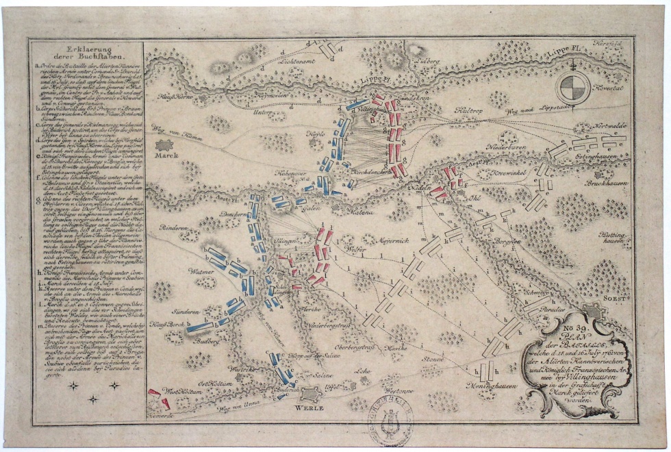
Plan der Schlacht bei Vellinghausen (Hellweg-Museum Unna CC BY-NC-SA)
Provenance/Rights: Hellweg-Museum Unna (CC BY-NC-SA)
1 / 2 Previous<- Next->

Plan der Schlacht bei Vellinghausen

Contact Cite this page Data sheet (PDF) Canonical version (record) Calculate distance to your current location Mark for comparison Graph view

Description

Vogelschauansicht des Gebietes südlich der Lippe zwischen Hemmerde und Soest mit topographischen Details und perspektivisch dargestellten Bäumen; die Stellungen der feindlichen Truppen sind eingezeichnet, teilweise farbig markiert (Stellung bei der Schlacht) und teilweise farblos (frühere Positionen und Marschwege); zudem sieht man die Angriffe zwischen den Stellungen als sich kreuzende Linien; im Süden ist der Hellweg (Straße von Unna") sowie die Saline in Werl eingezeichnet; links eine ausführliche Legende zur Schlacht.

Measurements

H 20 cm (Blatt) & 18,5 cm (Platte) ; B 29,8 cm (Blatt) & 28,3 cm (Platte)

Literature

  • Gabriel, Peter: (1999): &quot;Siegreich Schlachtfeld ists&quot; : 1761 - die vielen tausend Toten von Vellinghausen. In: Jahrbuch Westfalen. - 54. 2000 (1999) S. 150-155
Hellweg-Museum Unna

Object from: Hellweg-Museum Unna

Das 1928 gegründete Hellweg-Museum Unna ist seit 1936 in der für Graf Engelbert III. von der Mark erbauten Stadtburg untergebracht. Schwerpunkte...

Contact the institution

[Last update: ]

Usage and citation

The textual information presented here is free for non-commercial usage if the source is named. (Creative Commons Lizenz 3.0, by-nc-sa) Please name as source not only the internet representation but also the name of the museum.
Rights for the images are shown below the large images (which are accessible by clicking on the smaller images). If nothing different is mentioned there the same regulation as for textual information applies.
Any commercial usage of text or image demands communication with the museum.