museum-digital
CTRL + Y
en
Museen Burg Altena Grafik [00038]
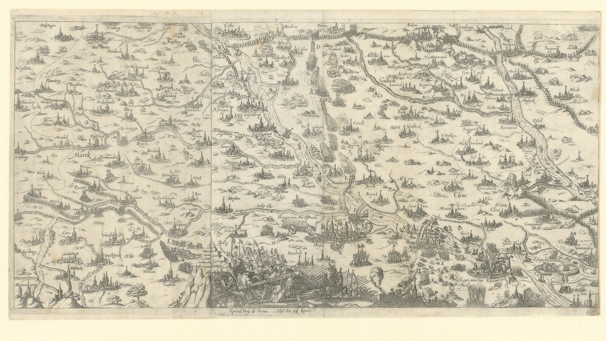
Landkarte mit Städtedarstellungen in den jülisch clevischen Landen (Museen Burg Altena CC BY-NC-SA)
Provenance/Rights: Museen Burg Altena (CC BY-NC-SA)
1 / 1 Previous<- Next->

Landkarte mit Städtedarstellungen in den jülisch clevischen Landen

Cite this page Data sheet (PDF) Canonical version (record) Calculate distance to your current location Mark for comparison Graph view

Description

Querformatiger Kupferstich mit einer Landkarte des Bereiches vom östlichen Westfalen bis in die Niederlande, aus zwei Blättern zusammengesetzt. Die Städte sind mit Miniaturansichten dargestellt, in vertauschter Anordnung der Himmelsrichtungen. Am unteren Kartenrand steigt Mars aus einem Grab, über ihm angreifende Truppen. Niederländische Bildunterschrift.

Material/Technique

Büttenpapier; gedruckt (Kupferstich)

Measurements

Blatt: H 24,4 cm; B 46,5 cm; Motiv: H 20,3 cm; B 46 cm; Passepartout: H 50 cm; B 70 cm

Map
Museen Burg Altena

Object from: Museen Burg Altena

Die ab dem 12. Jh. errichtete Burg Altena, ursprünglich Stammburg der Grafen von Altena-Mark, wurde 1909 bis 1915 historistisch überformt und u. a....

[Last update: ]

Usage and citation

The textual information presented here is free for non-commercial usage if the source is named. (Creative Commons Lizenz 3.0, by-nc-sa) Please name as source not only the internet representation but also the name of the museum.
Rights for the images are shown below the large images (which are accessible by clicking on the smaller images). If nothing different is mentioned there the same regulation as for textual information applies.
Any commercial usage of text or image demands communication with the museum.