museum-digital
CTRL + Y
en
Stiftung Händel-Haus Halle Bilder- und Graphiksammlung [BS-IIa 144]
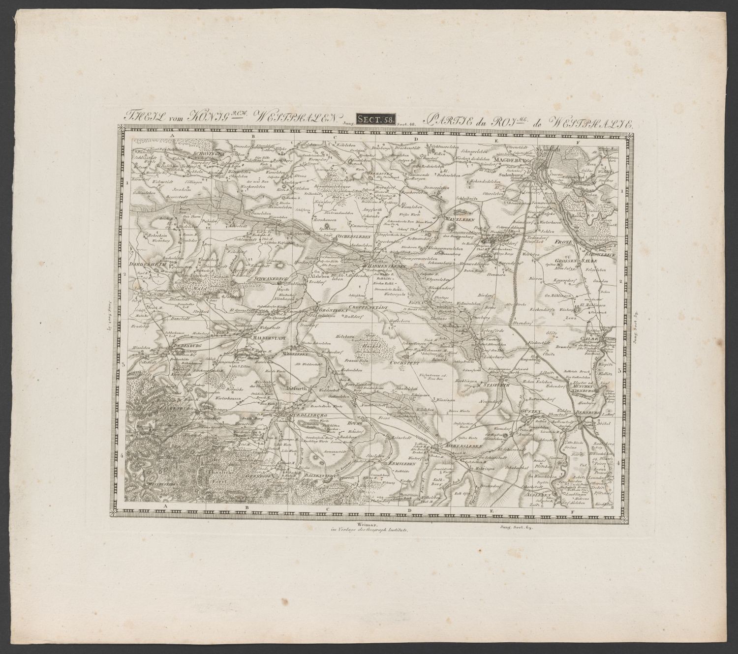
Landkarte, Westphalen (Stiftung Händelhaus, Halle CC BY-NC-SA)
Provenance/Rights: Stiftung Händelhaus, Halle (CC BY-NC-SA)
1 / 2 Previous<- Next->

Landkarte, Westphalen

Contact Cite this page Data sheet (PDF) Canonical version (record) Calculate distance to your current location Mark for comparison Graph view

Description

Die Landkarte zeigt einen Ausschnitt des östlichen Teils des Königreiches Westphalen, d.h. etwa den Bereich zwischen Blankenburg und Magdeburg. Das Königreich bestand von 1807 bis 1813 und umfasste etwa das Gebiet von Marburg bis zur Elbe. Es entstand in der Folge der Napoleonischen Kriege und war als Teil des Rheinbundes ein französischer Satellitenstaat, der von Napoleons Bruder Jerôme beherrscht wurde. Die Karte ist nicht koloriert. Ein Register zur Klärung der Zeichen gibt es nicht. Dies wird nur im Band der Fall sein, aus dem das Blatt stammt, nämlich die "Topographisch-militairische Charte von Teutschland in 204 Sectionen", erschienen in Weimar.

Beschriftung: Theil vom Königrch. Westphalen. / Partie du Royme. de Westphalie. Sect. 58

Wasserzeichen: VELINCCO (?)

Material/Technique

Kupferstich

Measurements

H: 50 cm; B: 56,3 cm (Blattmaß). H: 33,9 cm; B: 45 cm (Plattenmaß)

Stiftung Händel-Haus Halle

Object from: Stiftung Händel-Haus Halle

1937 erwarb die Stadt Halle das in der Großen Nikolaistraße gelegene Geburtshaus des berühmten Komponisten Georg Friedrich Händel und eröffnete hier...

Contact the institution

[Last update: ]

Usage and citation

The textual information presented here is free for non-commercial usage if the source is named. (Creative Commons Lizenz 3.0, by-nc-sa) Please name as source not only the internet representation but also the name of the museum.
Rights for the images are shown below the large images (which are accessible by clicking on the smaller images). If nothing different is mentioned there the same regulation as for textual information applies.
Any commercial usage of text or image demands communication with the museum.