museum-digital
CTRL + Y
en
Hunsrück-Museum Simmern Stadt- und Regionalgeschichte [2002.05]
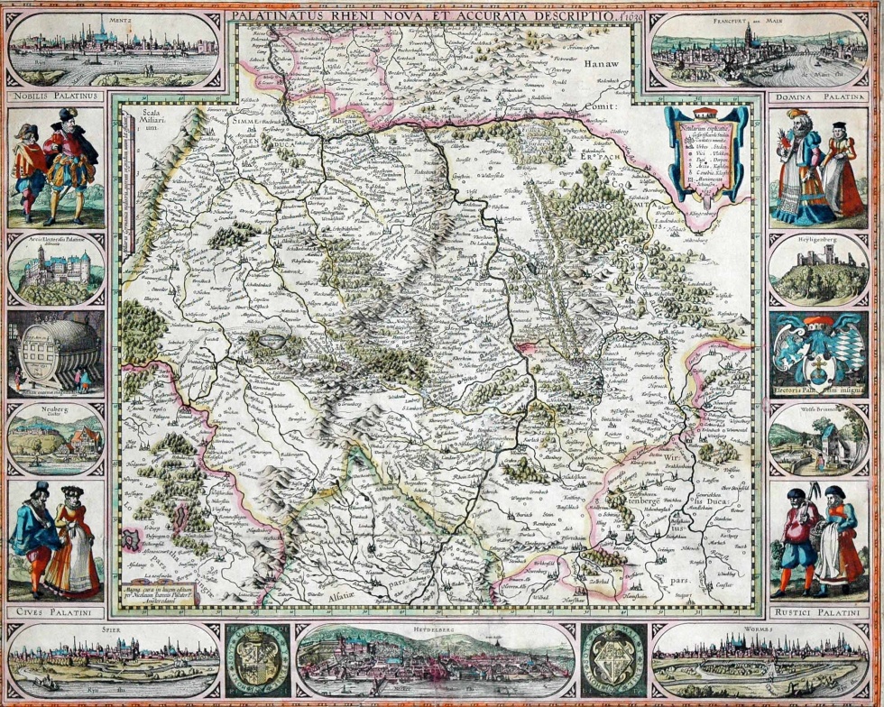
Kupferstichkarte der Kurpfalz (Hunsrück-Museum Simmern CC BY-NC-SA)
Provenance/Rights: Hunsrück-Museum Simmern (CC BY-NC-SA)
1 / 1 Previous<- Next->

Kupferstichkarte der Kurpfalz

Contact Cite this page Data sheet (PDF) Canonical version (record) Calculate distance to your current location Mark for comparison Graph view

Description

Altkolorierte Kupferstichkarte der Kurpfalz mit zahlreichen Motiven am Rand: Stadtansichten von Heidelberg, Speyer, Frankfurt, Worms, Heidelberger Schloss, Kloster Neuberg, Heiligenberg, Wolfbrunnen, Heidelberger Fass; Adelige, Edelleute, Bürger und Bauern.
Beschriftung der Kopfzeile: Palatinatus Rheni Nova et accurata descriptio

Material/Technique

Papier, Druck

Measurements

47,5 cm x 57,5 cm

Literature

  • Hellwig, Fritz; Reiniger, Wolfgang; Stopp, Klaus (1984): Landkarten der Pfalz am Rhein 1513 - 1803, Seite 108. Bad Kreuznach
  • Schellack, Fritz (2010): Zu Alltags- und Lebensverhältnissen im 16. und 17. Jahrhundert. in Hunsrücker Heimatblätter Nr. 143, Jahrgang 50, Seite 155-156
Map
Hunsrück-Museum Simmern

Object from: Hunsrück-Museum Simmern

Das Hunsrück-Museum wurde 1921 als ein Heimatmuseum gegründet. Bis 1930 war es im Schinderhannesturm in Simmern untergebracht. Anschließend kam die...

Contact the institution

[Last update: ]

Usage and citation

The textual information presented here is free for non-commercial usage if the source is named. (Creative Commons Lizenz 3.0, by-nc-sa) Please name as source not only the internet representation but also the name of the museum.
Rights for the images are shown below the large images (which are accessible by clicking on the smaller images). If nothing different is mentioned there the same regulation as for textual information applies.
Any commercial usage of text or image demands communication with the museum.