museum-digital
CTRL + Y
en
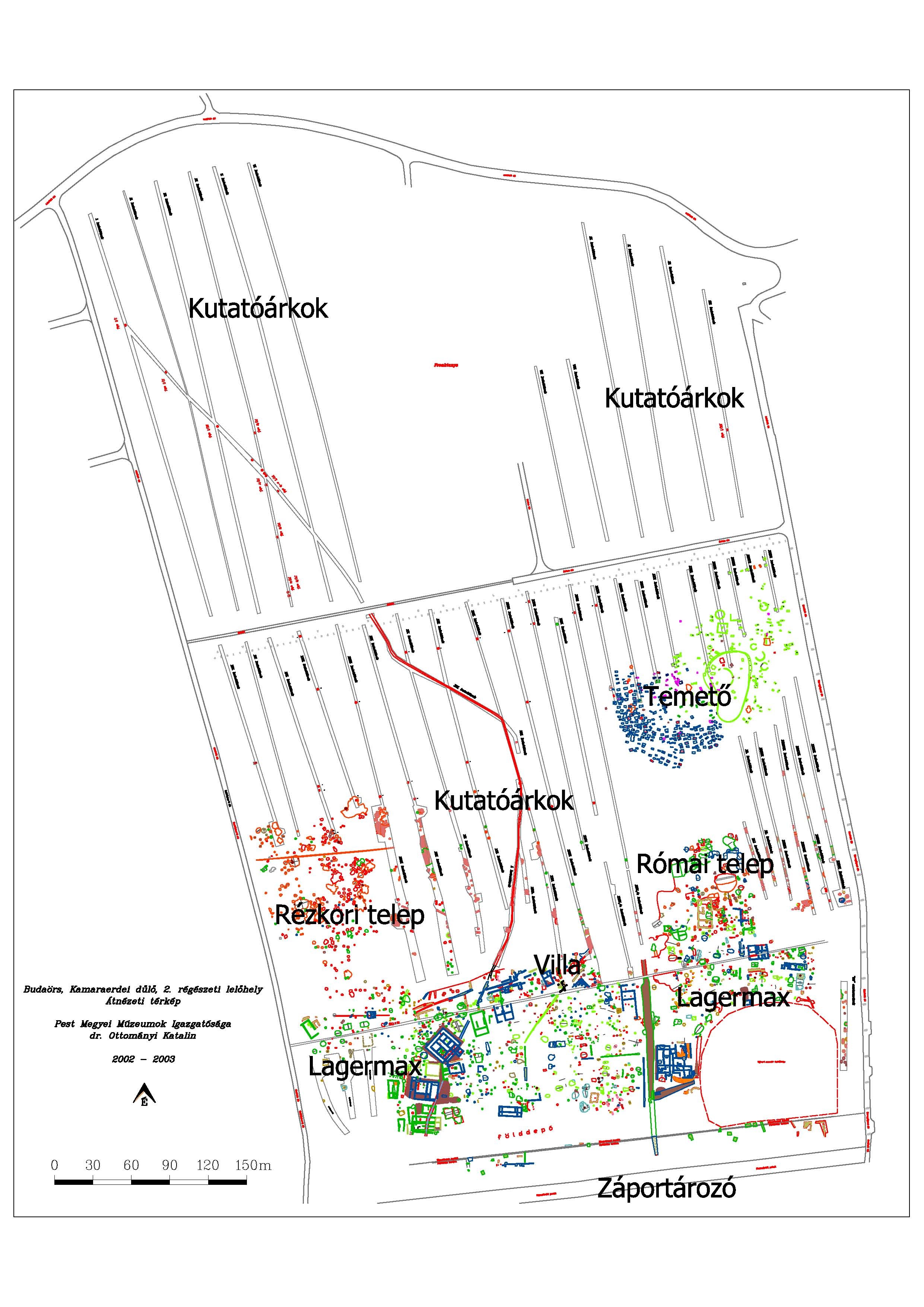
Ferenczy Múzeumi Centrum Régészeti, Történeti és Néprajzi Adattár [SZFM_A_4998-2006]
geodéziai térképek (Ferenczy Múzeumi Centrum CC BY-NC-SA)
Provenance/Rights: Ferenczy Múzeumi Centrum (CC BY-NC-SA)
1 / 2 Previous<- Next->

Geodéziai térképek

Cite this page Data sheet (PDF) Canonical version (record) Calculate distance to your current location Mark for comparison Graph view

Description

A budaörsi telep és temető feltárás geodéziai térképei. Eredeti változat és színezett (nem végleges térképek).

Material/Technique

Papir és digitális

Measurements

12 db A3-as, 2 db nagy térkép és tekercsek

Literature

  • Ottományi Katalin (2012): Római vicus Budaörsön. Budapest
Map
Created Created
2002
Geoservice Kft.
Budaörs
Created Created
2004
Stonehenge Kft.
Found Found
2002
Ottományi Katalin (1956-)
Budaörsi-Kamaraerdő
2001 2006
Ferenczy Múzeumi Centrum

Object from: Ferenczy Múzeumi Centrum

A városi helytörténeti gyűjteményként alapított, Ferenczy Károly festőművész nevét viselő szentendrei városi múzeum 1951-ben jött létre. 1973-ban a...

[Last update: ]

Usage and citation

The textual information presented here is free for non-commercial usage if the source is named. (Creative Commons Lizenz 3.0, by-nc-sa) Please name as source not only the internet representation but also the name of the museum.
Rights for the images are shown below the large images (which are accessible by clicking on the smaller images). If nothing different is mentioned there the same regulation as for textual information applies.
Any commercial usage of text or image demands communication with the museum.