museum-digital
CTRL + Y
en
Stadtmuseum Andernach Alter Krahnen [FM-63/92]
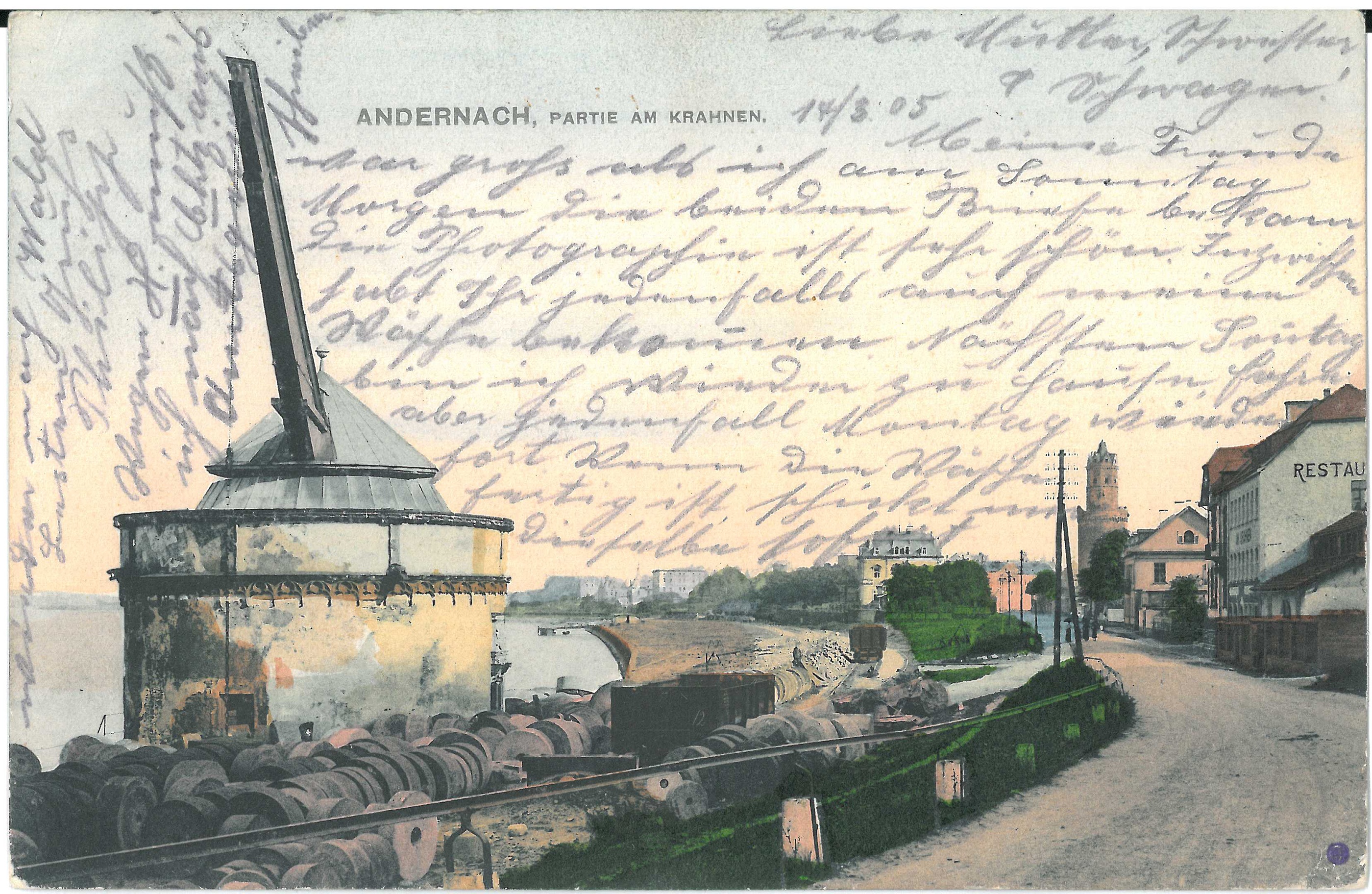
Postkarte mit Abbildung des Alten Krahnen (Stadtmuseum Andernach CC BY-NC-SA)
Provenance/Rights: Stadtmuseum Andernach (CC BY-NC-SA)
1 / 1 Previous<- Next->

Postkarte mit Abbildung des Alten Krahnen

Contact Cite this page Data sheet (PDF) Canonical version (record) Calculate distance to your current location Mark for comparison Graph view

Description

Die Postkarte zeigt eine Abbildung des Altenkrahnen aus Nordwesten mit vorgelagertem Mühlsteinlager. Außerdem kann man die Eisenbahnlinie erkennen, die schon 1879 zum Krahnen hin verlief. Am rechten Bildrand ist das Restaurant "Zum Krahnen" und etwas weiter hinten der Runde Turm zu erkennen. In der Bildmitte befindet sich hinter Bäumen die Villa Michels. Die Rheinanlagen bestanden zu diesem Zeitpunkt noch nicht. Die Straße ist die heutige Kölner Straße und ehemalige B9. Die Abbildung zeigt den Zustand des Geländes um 1900.

Measurements

H.: 9cm; Br.: 14cm

Map
Stadtmuseum Andernach

Object from: Stadtmuseum Andernach

Es zeigt die reichhaltige Stadtgeschichte

Contact the institution

[Last update: ]

Usage and citation

The textual information presented here is free for non-commercial usage if the source is named. (Creative Commons Lizenz 3.0, by-nc-sa) Please name as source not only the internet representation but also the name of the museum.
Rights for the images are shown below the large images (which are accessible by clicking on the smaller images). If nothing different is mentioned there the same regulation as for textual information applies.
Any commercial usage of text or image demands communication with the museum.